


HIRAM TOWNSHIP B Voting District, Portage County, Ohio
About
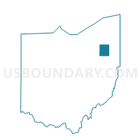
Outline

Summary
| Unique Area Identifier | 651071 |
| Name | HIRAM TOWNSHIP B Voting District |
| County | Portage County |
| State | Ohio |
| Area (square miles) | 14.87 |
| Land Area (square miles) | 14.79 |
| Water Area (square miles) | 0.08 |
| % of Land Area | 99.45 |
| % of Water Area | 0.55 |
| Latitude of the Internal Point | 41.30057100 |
| Longtitude of the Internal Point | -81.13352020 |
Maps


Graphs
Select a template below for downloading or customizing gragh for HIRAM TOWNSHIP B Voting District, Portage County, Ohio


Neighbors
Neighoring Voting District (by Name) Neighboring Voting District on the Map
- FREEDOM A Voting District, Portage County, OH
- GARRETTSVILLE A Voting District, Portage County, OH
- GARRETTSVILLE B Voting District, Portage County, OH
- HIRAM TOWNSHIP A Voting District, Portage County, OH
- HIRAM VILLAGE Voting District, Portage County, OH
- MANTUA TWP D Voting District, Portage County, OH
- NELSON A Voting District, Portage County, OH
- Voting District Parkman Twp B, Geauga County, OH
- SHALERSVILLE B Voting District, Portage County, OH
- Voting District Troy Twp A, Geauga County, OH
- Voting District Troy Twp B, Geauga County, OH
Top 10 Neighboring County Subdivision (by Population) Neighboring County Subdivision on the Map
- Shalersville township, Portage County, OH (5,670)
- Mantua township, Portage County, OH (4,811)
- Parkman township, Geauga County, OH (4,131)
- Nelson township, Portage County, OH (3,148)
- Freedom township, Portage County, OH (2,843)
- Troy township, Geauga County, OH (2,801)
- Hiram township, Portage County, OH (2,411)
- Garrettsville village, Portage County, OH (2,325)
- Hiram village, Portage County, OH (1,406)
Top 10 Neighboring Place (by Population) Neighboring Place on the Map
Top 10 Neighboring Unified School District (by Population) Neighboring Unified School District on the Map
- Cardinal Local School District, OH (15,214)
- Crestwood Local School District, OH (14,788)
- Berkshire Local School District, OH (9,330)
- James A. Garfield Local School District, OH (8,807)
Top 10 Neighboring State Legislative District Lower Chamber (by Population) Neighboring State Legislative District Lower Chamber on the Map
Top 10 Neighboring State Legislative District Upper Chamber (by Population) Neighboring State Legislative District Upper Chamber on the Map
Top 10 Neighboring 111th Congressional District (by Population) Neighboring 111th Congressional District on the Map
Top 10 Neighboring Census Tract (by Population) Neighboring Census Tract on the Map
- Census Tract 6002, Portage County, OH (5,854)
- Census Tract 6005, Portage County, OH (5,670)
- Census Tract 6001.03, Portage County, OH (5,473)
- Census Tract 3121, Geauga County, OH (4,131)
- Census Tract 6001.02, Portage County, OH (3,817)
- Census Tract 6006.02, Portage County, OH (2,843)
- Census Tract 3120, Geauga County, OH (2,801)